Installation of Solar Panels at Minster Abbey –
Archaeological Watching Brief
 We received permission to proceed with the installation of solar panels on March 29, 2022.
There followed an extended discussion between English Heritage and the Thanet Council Conservation Department: should the cable route from the paddock with the solar panels go below or above ground? Eventually it was decided that “a cable running below ground in a trench will link the solar array leading to the outbuildings that will house the control units and batteries”.
Mr Ges A. Moody from Thanetarch Archaeological Services was given a Watching Brief and spent a day observing and supervising the excavation.
He produced a magnificent Report, including invaluable material about the historical and archaeological background to the Abbey site and the surrounding area. All technical detail in the following account is taken from his report.
 Drawings of Ordnance Surveyors from 1797 and a Tithe Map of 1843 show two barns on the north side of what is now the farm yard, roughly parallel to the big Manorial (Tithe) Barn. The First Edition Ordnance Survey map of 1872 shows a longer structure on the west side of the yard. There is nothing left now above ground to show where exactly any of these buildings were situated.
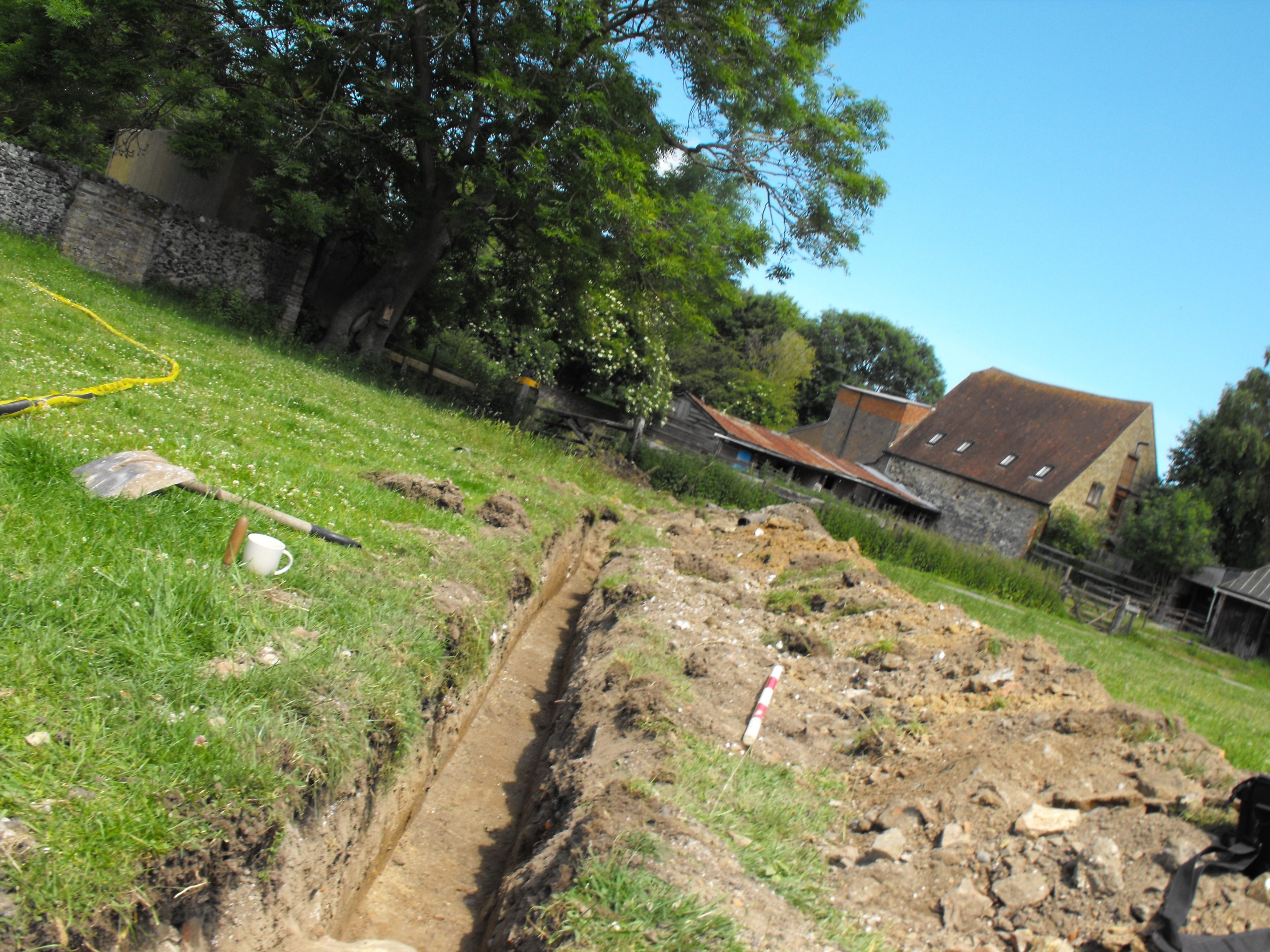
The mechanical digger, fitted with a flat bladed bucket began to excavate a trench 0.45 meters wide and 0.65m deep, starting from the south-east corner of the yard and leading diagonally towards the paddock. Ges Moody took photos and measurements during the excavation and made records of deposit profiles.
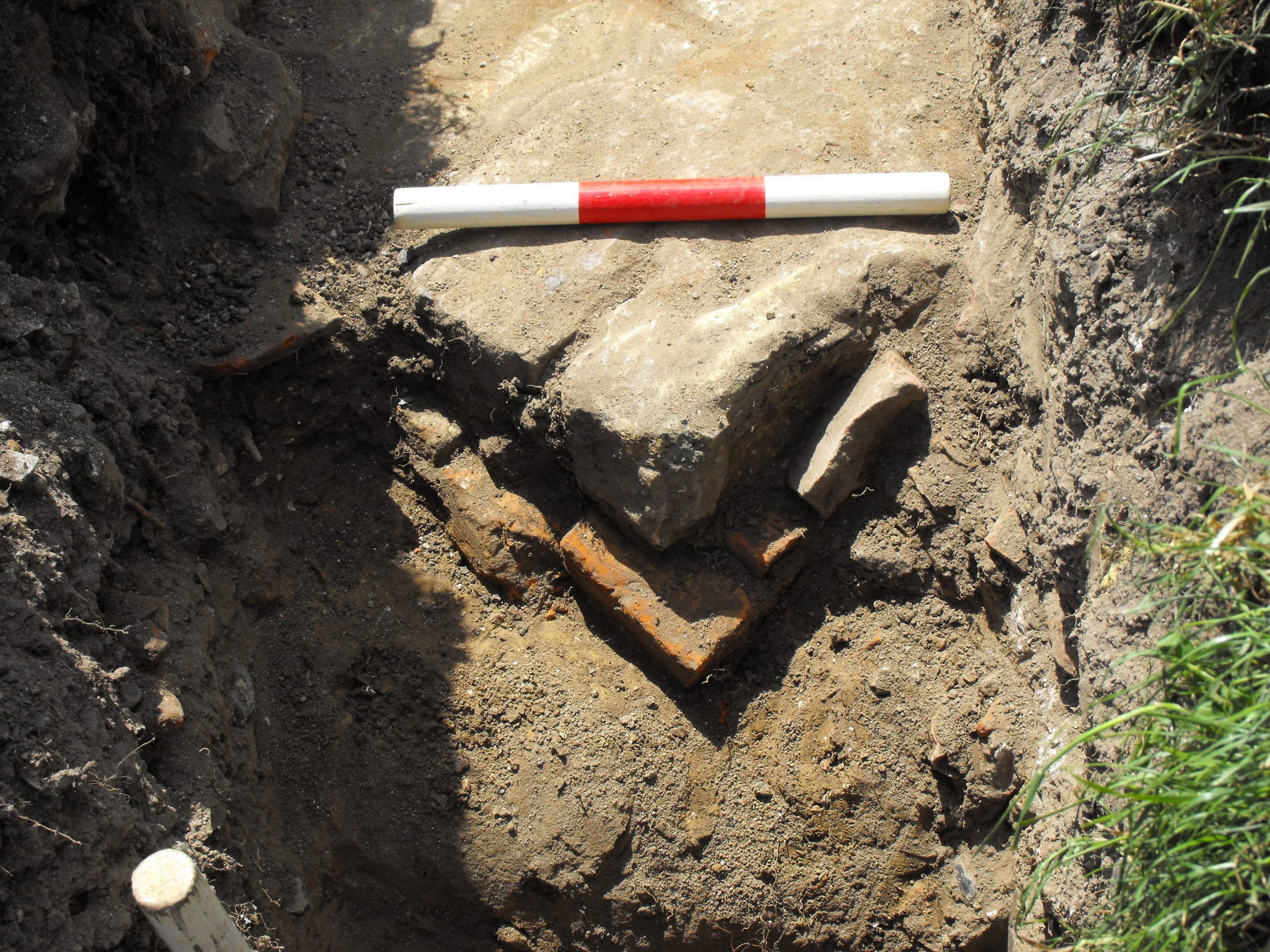
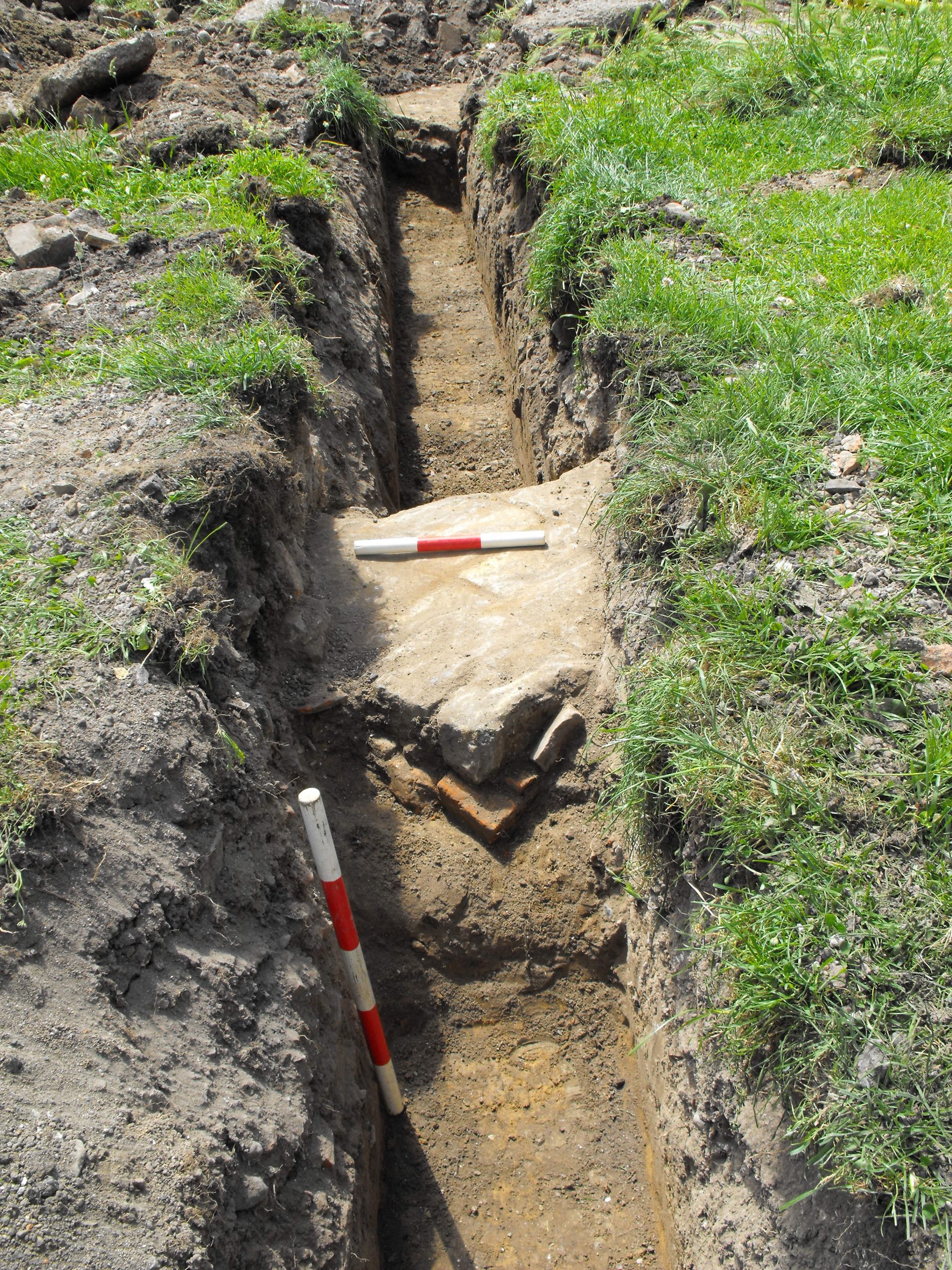
Half-way through the morning we heard that ‘something’ had been discovered and we began to gather in the yard to watch. The work had to proceed very slowly and carefully, so we had time to ask questions and Ges was happy to explain what was coming to light. The report states soberly, “Two areas of surviving consolidated masonry were encountered. Both had surfacing formed of brick laid in parallel and covered in a thin layer of very hard mortar, possibly a later screed over an original brick floor.” This measured account hardly conveys the excitement with which we watched the structures emerge.
“Judging by the location of the buildings, the structures could have been stables and perhaps an area was strengthened for an anvil in the yard, associated with a smithy for shoeing the horses.”
 A third area of “apparently structural remains” was excavated, consisting of “a rectangular chalk block and against it a densely packed irregular cluster of flint cobbles and brick fragments, …aligned with the north-south boundary recorded on historic mapping.” This may well have been the “stub wall foundation for a timber framed arm building or the footing of a boundary wall, or both…”
The trench continued towards the gate of the paddock designated for the solar panels. Close to the gate it “encountered pent up groundwater from the spring line in the chalk, which eventually settled to run gently towards the east. This part of the (yard) seems to have been consolidated over an area where ground water is building up because of an underlying spring.”
In his Report Ges Moody writes that “even in its high Medieval phase of occupation, the function of the complex of buildings was (predominantely) as a Grange, a grain collection centre for a Manor that was held by the Monastic House at St Augustine’s Canterbury… The deep hollow ways that lead to Bedlam Court Lane (our drive entrance) and through to the once majestic Manorial Barn attest to the significance of the Grange within Thanet’s agricultural production system. It was for this reason that the monastic houses were eventually dispossessed and broken up and the former land holdings distributed to a new class of landed gentry.”
While we were watching the excavations in progress Ges also told us of his own research into the archaeology of the Minster area: there is multiple evidence of a prehistoric settlement; there is the Roman Villa from the (1st to 2nd century) to the north-east of the Abbey farmland; piers or quays built of heavy stone slabs with iron mooring rings are said to have been found about 2 metres below ground level at Durlock and south of St Mary’s Church yard. If boats were indeed able to moor at Durlock the harbour would have been only a stone’s throw from the big Tithe barn, facilitating shipping the stored grain to Canterbury and up the Thames for sale at Rochester and London.
Ges Moody concludes his Report:
“The watching brief on the establishment of another facility for increasing the self-sustaining independence of the Community now resident at Minster Court has provided an opportunity to explore the location of some of the wider facilities for agricultural production (in the area) …, and has also given an insight into how the natural environment continues to assert itself as the struggle to manage the underlying springs and maintain and orderly farm were attested in the pattern of deposits encountered.”
We are grateful to Ges Moody for his expert supervision during the excavations, for his comprehensive report and for sharing his in-depth knowledge of the archaeology of the area. We are hoping to invite him back to tell us more about his research into this place with its rich history.